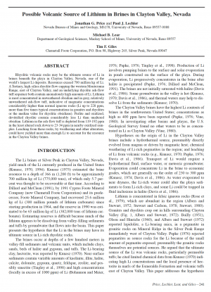
Additional information
| Type | |
|---|---|
| Primary Author | R. Eliason |
| Year | |
| County | |
| State | |
| Country | |
| Commodity | |
| Trend | |
| Mining District |

$10.00
The Jerritt Canyon mining district is located in the northern Independence
Mountains, approximately 70 km (45 miles) north of Elko, Nevada. The district has
been the site of gold exploration and mining since the early 1970’s, and more than
seven million ounces of gold have been produced from open pit and underground
mines since 1981. Current annual production is approximately 250,000 ounces of gold
from four underground mines.
The Independence Mountain range is a north-south horst block of Paleozoic
marine sedimentary rocks with Tertiary volcanics and associated clastic sediments
along the flanks. Continental slope and inner basin carbonate rocks of the Devonian-
Silurian Roberts Mountains Formation and the Silurian-Ordovician Hanson Creek
Formation are the primary hosts for gold mineralization in the district. They are
exposed in erosional and tectonic windows through the siliciclastic units of the
Roberts Mountains Allochthon (the upper plate of the Roberts Mountains thrust
fault). Early Pennsylvanian, late Eocene and Miocene dikes intrude the sedimentary
rocks. The Pennsylvanian and Eocene dikes host gold mineralization at several locations
in the district. The Eocene age provides a maximum constraining age for mineralization
in the district.
The structural setting in the district is complex. The Late Devonian to Early Mississippian
Antler orogeny and the Late Permian to Middle Triassic Sonoma orogeny
have folded, normal faulted and imbricate thrust faulted rocks throughout the range.
Other tectonic events that may have affected the district include the Late Jurassic
Nevadan orogeny and the Cretaceous to early Tertiary Sevier orogeny. Extensional tectonism
followed each of these compressional events and continues to the present day.
Gold deposits are spatially associated with both high and low angle faults, intersections
of faults, favorable stratigraphic horizons and folds. Fracture patterns at district
and mine scales show a periodicity to the distance between ore bearing
structures. Intersections of these structures are preferred locations of strong mineralization
and ore bodies. Folding of the host rocks also focused mineralization as many
of the gold deposits in the district are situated along the limbs of folds.
Seventy percent of the surface area of the Jerritt Canyon mining district is covered
with siliciclastic rocks of the Roberts Mountains Allochthon (the Snow Canyon Formation).
These rocks generally do not host gold mineralization, and they mask the geology
of the underlying favorable strata. Applying the relation of gold mineralization to
structures as understood from the known deposits is an effective exploration tool.
| Type | |
|---|---|
| Primary Author | R. Eliason |
| Year | |
| County | |
| State | |
| Country | |
| Commodity | |
| Trend | |
| Mining District |